Thanks, BB. Tazmania seems to be about to get hit badly, too.
And parts of London are now under water...sheesh...hard to keep up!
http://www.standard.co.uk/news/london/w ... 5831.htmld


PeakOil is You
THE Deluge Thread (merged)
Re: Deluge Thread 2016
![]() by dohboi » Tue 07 Jun 2016, 22:53:34
by dohboi » Tue 07 Jun 2016, 22:53:34
-
dohboi - Harmless Drudge

- Posts: 19990
- Joined: Mon 05 Dec 2005, 04:00:00
Re: Deluge Thread 2016
![]() by dohboi » Tue 14 Jun 2016, 23:09:53
by dohboi » Tue 14 Jun 2016, 23:09:53
and yet more mayhem...this chaos is really becoming the norm almost everywhere...
https://www.youtube.com/watch?v=7uxueMnAt0o
https://www.youtube.com/watch?v=7uxueMnAt0o
-
dohboi - Harmless Drudge
- Posts: 19990
- Joined: Mon 05 Dec 2005, 04:00:00
Re: Deluge Thread 2016
![]() by dohboi » Thu 23 Jun 2016, 19:36:00
by dohboi » Thu 23 Jun 2016, 19:36:00
Lot of record rainfall around the world these past few months, in both hemispheres:
http://www.centralwesterndaily.com.au/s ... or-orange/
http://www.kcrg.com/content/news/Near-r ... 09361.html
http://www.skymetweather.com/content/we ... -rainfall/
http://www.ktva.com/record-rainfall-rec ... orage-310/
http://www.dailypress.com/news/weather/ ... story.html
http://lacrossetribune.com/news/local/rainfall-breaks–year-old-record/article_315ff55b-45bc-5933-a320-392d7d68d8d4.html
http://www.fox4now.com/weather/record-r ... t-ten-days
http://www.theeagle.com/news/local/wash ... 37f59.html
http://wncn.com/2016/06/04/record-rains ... ter-banks/
http://www.japantimes.co.jp/news/2016/0 ... 2u9Hrh9671
http://www.brisbanetimes.com.au/queensl ... pindn.html
...
Of course, some record is likely to be set somewhere in the world in any given year or even day, but all these rain records mean that an unusual amount of water is being wrung from the atmosphere. Doubtless the unwinding El Nino has something to do with it, but of course these records are exceeding anything that happened at the end of any other El Nino.
(Thanks to BDJ at rs's blog for these.)
http://www.centralwesterndaily.com.au/s ... or-orange/
MOST residents slept through it but Wednesday’s rain tipped Orange to a June rainfall record.
Up to 9am on Wednesday, 37mm fell during the night meaning Orange has been drenched by 234.6 mm this month.
According to Weatherzone.com, our previous mark was 178.6 which fell in 1998.
For the record, Orange’s long-term average rainfall for June is 73.3mm.
http://www.kcrg.com/content/news/Near-r ... 09361.html
According to the National Weather Service, Dubuque received 3.5 inches of rain through midnight last night. That total is just .16 of an inch away from the all-time record.
http://www.skymetweather.com/content/we ... -rainfall/
Hisar, district of Haryana state, recorded highest single day rainfall in last 24 hours. The ‘City of Steel’ recorded 93 mm of rain which broke its ten-year-old rainfall record.
Highest single day rainfall recorded during 2015 was 48 mm which is almost half the amount of rain recorded this year. The amount of rainfall recorded during 2014 was even lesser. Hisar has surpassed its average monthly rainfall for the month of June of 42.9 mm by almost double which it recorded in a single day on June 13. Moreover, weather forecast for the next 3 days in Hisar is partly cloudy sky with possibility of rain or thunderstorm.
http://www.ktva.com/record-rainfall-rec ... orage-310/
Anchorage saw record setting rainfall Monday.
At Ted Stevens International Airport, a record of 1.03 inches of rain was recorded. The amount surpassed the old daily rainfall record of 0.73 inches, which was recorded June 6, 1988. It was also the most significant rainfall amount the Anchorage area has seen since Sept. 8, 2015.
Monday’s rainfall was also one of the wettest June days on record. Only two other days during the month of June have seen more rainfall – June 12, 1962, with 1.62 inches, and June 14, 1978, with 1.23 inches. That makes June 6, 2016 the third wettest June day on record in Alaska biggest city.
http://www.dailypress.com/news/weather/ ... story.html
The Peninsula endured record-setting rainfall last month with more than 21 days of recorded precipitation.
The 10.17 inches of rain, more than 2.5 times the usual level, along with cooler temperatures allowed cold-season weeds to flourish on area golf courses.
http://lacrossetribune.com/news/local/rainfall-breaks–year-old-record/article_315ff55b-45bc-5933-a320-392d7d68d8d4.html
La Crosse was home to a mere 14,505 souls when the city endured a record rainfall of 1.59 inches on June 14, 1880, a mark that stood for 136 years — until a 1.92-inch gully washer Tuesday night took over the top spot for that date.
Of course, the nearly 2 inches was spread over a lot more people, with the La Crosse population now pushing 53,000, but a record is a record, and we’re in the books.
The Tuesday tally at the La Crosse Regional Airport not only sent the June total to 3.31 inches above normal for the month but also pushed the precipitation total for the year to 15.78 inches, 2.72 inches above normal, according to National Weather Service records.
http://www.fox4now.com/weather/record-r ... t-ten-days
The Tampa Office of the National Weather Service released their preliminary rainfall totals and it shows some staggering numbers! It reveals that while Fort Myers and other areas may have experienced relentless rain, the prize goes to Punta Gorda when it comes to accumulations. In just the first 10 ten days of June, the measuring station at Punta Gorda Airport recorded 10.43 inches of rain, making it already the wettest June since record- keeping began in 1914. That’s an average of nearly one inch of rain a day! There were two days where more than two inches of rain fell (the 4th and 9th). Now, keep in mind Punta Gorda typically averages 8.94 inches for the month of June. It looks like now Punta Gorda could come close to doubling that before the month ends.
http://www.theeagle.com/news/local/wash ... 37f59.html
http://wncn.com/2016/06/04/record-rains ... ter-banks/
“Tropical Storm Bonnie dropped 7-8 inches of rain in areas on Hatteras Island. Over 7 inches of rain fell near the Frisco Campground, breaking a record for daily rainfall and resulting in record rainfall for the month of May,” Cape Hatteras National Seashore officials wrote on Facebook.
http://www.japantimes.co.jp/news/2016/0 ... 2u9Hrh9671
The rain, which began Monday, dropped a record 150 mm of rain per hour on the town of Kosa through early Tuesday and 122 mm per hour on the city of Uto.
The city of Unzen in Nagasaki Prefecture recorded 124.5 mm per hour.
http://www.smh.com.au/environment/rainy ... pc04n.html
In less than 48 hours, the heavy downpours passed the average total June rainfall of 132 millimetres, causing localised flash floods across the city.
Bankstown received its heaviest daily rainfall in 15 years, with 141 millimetres of rain in the 24 hours to 9am Sunday.
http://www.brisbanetimes.com.au/queensl ... pindn.html
Rainfall in central west Queensland has broken rain records as graziers rejoice in a break from the devastating drought.
Longreach soaked up 34mm on the first day of June and a whopping 59mm was measured at 9am Monday morning.
By Tuesday morning, another 22mm was been recorded.
Barcaldine also managed to get a drink with 78mm falling onto parched land since Sunday.
Queensland rainfall as recorded on Monday. The bureau predicts the state’s south-east will be drenched at the weekend.
Queensland rainfall as recorded on Monday. The bureau predicts the state’s south-east will be drenched at the weekend.
Rainfall was centred around Longreach and expanded as far out as Winton and down to Blackall.
Bureau of Meteorology David Bernard said the rainfall had broken June records.
“Longreach had the wettest June total so far ever, it has never had a wetter June since records began,” he said.
...
Of course, some record is likely to be set somewhere in the world in any given year or even day, but all these rain records mean that an unusual amount of water is being wrung from the atmosphere. Doubtless the unwinding El Nino has something to do with it, but of course these records are exceeding anything that happened at the end of any other El Nino.
(Thanks to BDJ at rs's blog for these.)
-
dohboi - Harmless Drudge
- Posts: 19990
- Joined: Mon 05 Dec 2005, 04:00:00
Re: Deluge Thread 2016
![]() by onlooker » Tue 28 Jun 2016, 10:09:23
by onlooker » Tue 28 Jun 2016, 10:09:23
https://robertscribbler.com/2016/06/24/ ... -virginia/
Bad Rains Fall Across Globe — 700,000 Evacuated in Kyushu Deluge as Worst Flood in 100 Years Inundates West Virginia
Bad Rains Fall Across Globe — 700,000 Evacuated in Kyushu Deluge as Worst Flood in 100 Years Inundates West Virginia
"We are mortal beings doomed to die
-

onlooker - Fission

- Posts: 10957
- Joined: Sun 10 Nov 2013, 13:49:04
- Location: NY, USA
Re: Deluge Thread 2016
![]() by dohboi » Sun 03 Jul 2016, 07:10:33
by dohboi » Sun 03 Jul 2016, 07:10:33
http://abcnews.go.com/International/wir ... n-40309701
Overnight Flash Floods Kill 30 People in Northern Pakistan
::::::::::::::::::::::::::::::::
Mendenhall Lake floods following glacial outburst
http://www.ktva.com/mendenhall-lake-flo ... burst-476/
:::::::::::::::::::::::::::::::::
50 dead in China –
Torrential rain to last till Monday: meteorological authority
http://english.cri.cn/12394/2016/07/03/3742s932905.htm
Things are looking pretty dire all over the place. But then deniars gonna keep on denyin'.
Overnight Flash Floods Kill 30 People in Northern Pakistan
::::::::::::::::::::::::::::::::
Mendenhall Lake floods following glacial outburst
http://www.ktva.com/mendenhall-lake-flo ... burst-476/
:::::::::::::::::::::::::::::::::
50 dead in China –
Torrential rain to last till Monday: meteorological authority
Thunderstorms are forecast to hit the provinces of Hubei, Anhui, Jiangsu, Hunan, Jiangxi, Guizhou and Guangxi Zhuang Autonomous Region from Sunday morning to Monday morning, with precipitation reaching up to 220 millimeters in some areas……………… The province of Hubei, which is intersected by the lower-reaches of the Yangtze River, has been battered by rains for the past 3-days.
http://english.cri.cn/12394/2016/07/03/3742s932905.htm
Things are looking pretty dire all over the place. But then deniars gonna keep on denyin'.
-
dohboi - Harmless Drudge
- Posts: 19990
- Joined: Mon 05 Dec 2005, 04:00:00
Re: Deluge Thread 2016
![]() by vox_mundi » Sun 07 Aug 2016, 09:36:38
by vox_mundi » Sun 07 Aug 2016, 09:36:38
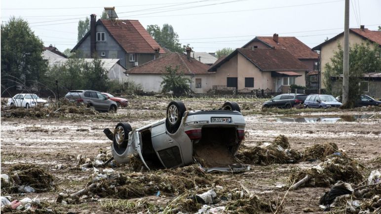
Macedonia storm: At least 20 die overnight in freak deluge
At least 20 people have died as storms caused Skopje, the capital of Macedonia, to flood.
Their bodies were found before 8:30 (06:30 GMT) on Sunday, an official said. Six people are still missing.
Some of the victims drowned in their cars. Parts of the city's ring road have been swept away in the floods, dragging cars into nearby fields.
Three-and-a-half inches (93mm) of rain fell in Skopje in the storm - more than the average for the whole of August.
The Mayor of Skopje, Kove Trajanovski, said: "This is a disaster. We have never experienced such a thing."
“There are three classes of people: those who see. Those who see when they are shown. Those who do not see.” ― Leonardo da Vinci
Insensible before the wave so soon released by callous fate. Affected most, they understand the least, and understanding, when it comes, invariably arrives too late.
Insensible before the wave so soon released by callous fate. Affected most, they understand the least, and understanding, when it comes, invariably arrives too late.
-

vox_mundi - Intermediate Crude
- Posts: 3939
- Joined: Wed 27 Sep 2006, 03:00:00
Re: Deluge Thread 2016
![]() by vox_mundi » Fri 12 Aug 2016, 16:05:14
by vox_mundi » Fri 12 Aug 2016, 16:05:14
Severe Flooding Hits Parts of Louisiana and Mississippi; One Dead
Extreme Rainfall Along Gulf Coast Measured By NASA's IMERG
Hot Gulf of Mexico Hurls Rain Bombs at Florida and the U.S. Gulf Coast

Heavy rain and widespread flooding in Louisiana lead the governor to declare a state of emergency on Friday, with more rain expected over the state through Saturday.
Numerous rivers in southeast Louisiana and southern Mississippi were overflowing their banks and threatening widespread flooding after extreme rainfall, the National Weather Service reported.
Mike Steele, a spokesman for the Governor's Office of Homeland Security and Emergency Preparedness, said requests were coming in for high-water vehicles, boats and sandbags.
Steele said Tangipahoa Parish alone requested tens of thousands of sandbags.
A flood watch remains in effect until Saturday across most of south Louisiana.
On Friday morning, the NWS reported rainfall rates of 2-3 inches per hour in southwest Mississippi and just north of Baton Rouge. Northeast of Baton Rouge, in St. Helena Parish, rainfall totals ranged between 6 to 9 and a half inches. The weather service said in a statement that an additional 3 to 5 inches could fall over the area.
The Tickfaw River, just south of the Mississippi state line in Liverpool, Louisiana, was already at the highest level ever recorded at 9 a.m. Friday.
Rescuers were still plucking people from floodwaters in Amite and Wilkinson counties in southwest Mississippi. ... "We woke up and the water kept on coming," Hansford said. "It came up to my waist." His wife told Hansford that it's the highest she's seen the creek in the 48 years she's lived there.
Keith Townson, manager of Shopper Value Foods in Amite, has lived in the area for 40 years.
"I've seen water in some places I have never seen before," Townson said, "and it's still coming down."

Extreme Rainfall Along Gulf Coast Measured By NASA's IMERG
For the better part of a week, a persistent, mid-level area of low pressure has been tapping into warm, moist air to produce stormy weather in the northeastern Gulf of Mexico, and satellite data of rainfall was collected and calculated at NASA.
The National Hurricane Center (NHC) monitored this stormy area for possible development but unfavorable upper-level winds and the close proximity to land prevented development into a tropical system. However, during the past week from as much as 4 inches (101.6 mm) to more than 15 inches (381 mm) of rain fell along the Gulf Coast from Tampa, Florida, northward through the state's Big Bend to as far west as central Louisiana. So far the highest rainfall totals have been offshore, nevertheless street flooding has been common in Florida counties along the Gulf Coast due to locally heavy downpours.
The results were made into an image and animation at NASA's Goddard Space Flight Center in Greenbelt, Maryland. These results show that the most extreme rainfall during this period fell over the waters of the northern Gulf of Mexico south of the Florida Panhandle, where IMERG estimates indicate that from about 20 inches (about 500 mm) to more than about 35 inches (about 900 mm) of precipitation may have fallen. Over coastal areas, the highest totals are on the order of 12 to 16 inches (about 300 to 400 mm) and occur mostly along the northeast and north-central Florida Gulf Coast, along with parts of southeastern Louisiana.
The lower pressure center responsible for triggering the showers and thunderstorms is expected to slowly retreat towards the northwest into the Lower Mississippi Valley bringing the threat for heavy rains and flooding to Louisiana. Parts of Louisiana, including New Orleans, and the Mississippi Gulf Coast are forecast to see as much as 10 inches of additional rain over the coming days.

Hot Gulf of Mexico Hurls Rain Bombs at Florida and the U.S. Gulf Coast
“There are three classes of people: those who see. Those who see when they are shown. Those who do not see.” ― Leonardo da Vinci
Insensible before the wave so soon released by callous fate. Affected most, they understand the least, and understanding, when it comes, invariably arrives too late.
Insensible before the wave so soon released by callous fate. Affected most, they understand the least, and understanding, when it comes, invariably arrives too late.
-
vox_mundi - Intermediate Crude
- Posts: 3939
- Joined: Wed 27 Sep 2006, 03:00:00
Re: Deluge Thread 2016
![]() by PeakOiler » Tue 16 Aug 2016, 17:59:23
by PeakOiler » Tue 16 Aug 2016, 17:59:23
Well, I've measured over 5.1" inches of rain in the last two days after not getting any measurable rainfall since early June. Does that qualify as a deluge? Actually, it's just weird Texas weather...
Five of eight of my rainwater collection tanks overflowed. I estimate my total rainwater collection at over 10k gallons. More rainfall is forecast over the next two days.
Flash flood watches are in effect until tomorrow night for Central Texas (Travis county-Austin).
Five of eight of my rainwater collection tanks overflowed.
I estimate my total rainwater collection at over 10k gallons. More rainfall is forecast over the next two days.Flash flood watches are in effect until tomorrow night for Central Texas (Travis county-Austin).
There’s a strange irony related to this subject [oil and gas extraction] that the better you do the job at exploiting this oil and gas, the sooner it is gone.
--Colin Campbell
--Colin Campbell
-

PeakOiler - Intermediate Crude
- Posts: 3664
- Joined: Thu 18 Nov 2004, 04:00:00
- Location: Central Texas
Re: Deluge Thread 2016
![]() by dohboi » Wed 17 Aug 2016, 09:07:14
by dohboi » Wed 17 Aug 2016, 09:07:14
More on the LA flood, with context: https://robertscribbler.com/2016/08/15/ ... entral-us/
For Louisiana, the Rains of Climate Change Fall Hard — More Heavy Storms Expected to Hit Central U.S.
http://www.wbrz.com/news/90-percent-of- ... e-tuesday/
Most people in Livingston Parish lost everything
http://www.nytimes.com/2016/08/17/us/cl ... .html?_r=0
Flooding in the South looks a lot like CC
-
dohboi - Harmless Drudge
- Posts: 19990
- Joined: Mon 05 Dec 2005, 04:00:00
Re: Deluge Thread 2016
![]() by ennui2 » Wed 17 Aug 2016, 21:17:54
by ennui2 » Wed 17 Aug 2016, 21:17:54
The floods tend to hit demographic regions with the most deap-seated AGW denial. Expect those affected to not connect the dots.
"If the oil price crosses above the Etp maximum oil price curve within the next month, I will leave the forum." --SumYunGai (9/21/2016)
-

ennui2 - Permanently Banned
- Posts: 3920
- Joined: Tue 20 Sep 2011, 10:37:02
- Location: Not on Homeworld
Re: Deluge Thread 2016
![]() by Subjectivist » Sun 18 Sep 2016, 17:31:07
by Subjectivist » Sun 18 Sep 2016, 17:31:07
Yikes, my new rain gauge read 41mm aka 1+5/8" over the last 24 hours, downpours alternated with drizzle all day Saturday and overnight.
II Chronicles 7:14 if my people, who are called by my name, will humble themselves and pray and seek my face and turn from their wicked ways, then I will hear from heaven, and I will forgive their sin and will heal their land.
- Subjectivist
- Volunteer
- Posts: 4703
- Joined: Sat 28 Aug 2010, 07:38:26
- Location: Northwest Ohio
Re: Deluge Thread 2016
![]() by dohboi » Wed 02 Nov 2016, 21:57:37
by dohboi » Wed 02 Nov 2016, 21:57:37
-
dohboi - Harmless Drudge
- Posts: 19990
- Joined: Mon 05 Dec 2005, 04:00:00
Re: Deluge Thread 2016
![]() by dohboi » Tue 08 Nov 2016, 10:13:54
by dohboi » Tue 08 Nov 2016, 10:13:54
flooding going on all over the world
Vietnam is one. http://floodlist.com/asia/vietnam-13-pr ... ember-2016
Also, Mexico. http://floodlist.com/america/mexico-flo ... ave-2-dead
And Haiti. http://floodlist.com/america/haiti-floo ... es-10-dead
(Thanks to Tigertown at neven's site for this)
Vietnam is one. http://floodlist.com/asia/vietnam-13-pr ... ember-2016
Also, Mexico. http://floodlist.com/america/mexico-flo ... ave-2-dead
And Haiti. http://floodlist.com/america/haiti-floo ... es-10-dead
(Thanks to Tigertown at neven's site for this)
-
dohboi - Harmless Drudge
- Posts: 19990
- Joined: Mon 05 Dec 2005, 04:00:00
Re: Deluge Thread 2016
![]() by dohboi » Thu 10 Nov 2016, 17:02:56
by dohboi » Thu 10 Nov 2016, 17:02:56
More severe flooding in Thailand and Indonesia, affecting thousands.
http://floodlist.com/asia/floods-indone ... ember-2016
http://floodlist.com/asia/floods-indone ... ember-2016
-
dohboi - Harmless Drudge
- Posts: 19990
- Joined: Mon 05 Dec 2005, 04:00:00
Re: Deluge Thread 2016
![]() by dohboi » Fri 11 Nov 2016, 10:32:42
by dohboi » Fri 11 Nov 2016, 10:32:42
-
dohboi - Harmless Drudge
- Posts: 19990
- Joined: Mon 05 Dec 2005, 04:00:00
Deluge Thread 2017
![]() by dohboi » Sun 01 Jan 2017, 23:36:23
by dohboi » Sun 01 Jan 2017, 23:36:23
http://www.straitstimes.com/asia/se-asi ... y-in-march
Floods in Malaysian states may end only in March –
WORST FLOODING IN [more than] 30 YEARS
Floods in Malaysian states may end only in March –
WORST FLOODING IN [more than] 30 YEARS
The flood today is even bigger than in 1986. The water rose very fast. In less than two hours, water had entered our house.
-
dohboi - Harmless Drudge
- Posts: 19990
- Joined: Mon 05 Dec 2005, 04:00:00
Re: Deluge Thread 2017
![]() by onlooker » Sun 02 Apr 2017, 14:34:01
by onlooker » Sun 02 Apr 2017, 14:34:01
http://www.nbcnews.com/news/world/colom ... ed-n741561
Colombia Mudslide: 193 Dead, 178 Missing After 3 Rivers Burst Banks
Colombia Mudslide: 193 Dead, 178 Missing After 3 Rivers Burst Banks
"We are mortal beings doomed to die
-
onlooker - Fission
- Posts: 10957
- Joined: Sun 10 Nov 2013, 13:49:04
- Location: NY, USA
Return to Environment, Weather & Climate
Who is online
Users browsing this forum: No registered users and 20 guests