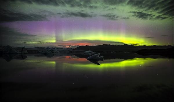
Re: THE Volcano Thread Pt. 2
http://en.vedur.is/media/jar/Bardarbung ... 140825.pdf
See picture p.9
Figure 5b. Maximum range of the 1 cm, 10 cm and 100 cm isopachs of the largest basaltic tephra layer erupted
in historical time, the ~10 km^3
(freshly fallen volume) Veiðivötn tephra (based on Larsen et al. 2013). Wind
direction remained between west and southwest throughout the tephra fall which partly explains how far from
source the isopachs extended
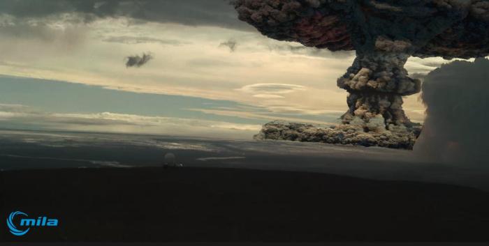
11. Largest known eruption
Effusive eruption: The eruption of the Great Thjórsá Lava (>20 km^3) about 8600 years ago is the largest known
eruption on the fissure swarm SW of Vatnajökull. The lava covers over 900 km^2
and was channelled via riverbeds of Tungnaá and Thjórsá more than 130 km from source to the south coast. Source area is not known in detail. The largest known eruption on the fissure swarm north of Vatnajökull is the Trölladyngja lava shield (~15 km^3), its age is not known in detail but is probably mid-Holocene. The lava field covers over 400 km^2
.
Explosive eruption: The large explosive basaltic eruption in 1477 CE took place on a ~65 km long volcanic
fissure on the southwestern part of the Veiðivötn fissure swarm where ground water level is high, and deposited
about 10 km^3 of tephra on land affecting 50% of the country (Figures 4 and 5b). Heavy proximal tephra fall
clogged water ways and volcanic craters dammed river Tungnaá resulting in formation of unstable lakes behind
tephra dams.
***************
So here you can see why Icelands population is in danger if >10 km^3 lava are in the game.
M_B_S
See picture p.9
Figure 5b. Maximum range of the 1 cm, 10 cm and 100 cm isopachs of the largest basaltic tephra layer erupted
in historical time, the ~10 km^3
(freshly fallen volume) Veiðivötn tephra (based on Larsen et al. 2013). Wind
direction remained between west and southwest throughout the tephra fall which partly explains how far from
source the isopachs extended
11. Largest known eruption
Effusive eruption: The eruption of the Great Thjórsá Lava (>20 km^3) about 8600 years ago is the largest known
eruption on the fissure swarm SW of Vatnajökull. The lava covers over 900 km^2
and was channelled via riverbeds of Tungnaá and Thjórsá more than 130 km from source to the south coast. Source area is not known in detail. The largest known eruption on the fissure swarm north of Vatnajökull is the Trölladyngja lava shield (~15 km^3), its age is not known in detail but is probably mid-Holocene. The lava field covers over 400 km^2
.
Explosive eruption: The large explosive basaltic eruption in 1477 CE took place on a ~65 km long volcanic
fissure on the southwestern part of the Veiðivötn fissure swarm where ground water level is high, and deposited
about 10 km^3 of tephra on land affecting 50% of the country (Figures 4 and 5b). Heavy proximal tephra fall
clogged water ways and volcanic craters dammed river Tungnaá resulting in formation of unstable lakes behind
tephra dams.
***************
So here you can see why Icelands population is in danger if >10 km^3 lava are in the game.
M_B_S